England Has a Buried Supervolcano, and It Rewrites Geological Risk
A 454-million-year-old supervolcano lurks beneath England's east coast, once blowing hundreds of cubic kilometers of ash across what is now Scandinavia. The discovery forces a rethink of how we map volcanic danger — and reminds us that the ground beneath one of Europe's most exposed regions once harbored something far more violent.
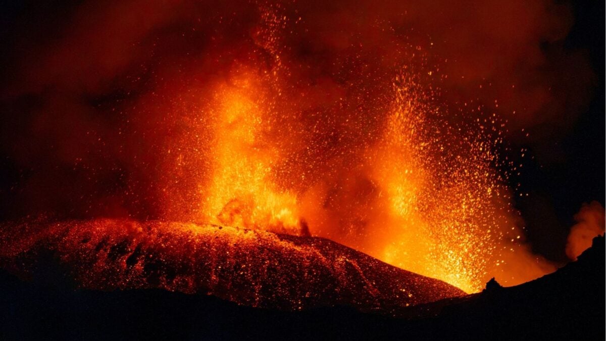
The Ground You Walk On Once Blew Up
England is not supposed to have a supervolcano. The stereotype — and the textbook image — of British geology is mild: rolling hills, sedimentary rock, the occasional volcanic remnant in Scotland. Nothing with the teeth of Yellowstone or the Tonga-Kermadec arc. So when researchers announced the discovery of a massive, long-buried supervolcano beneath the Wash, England’s east coast estuary, the reaction wasn’t panic. It was something rarer: a genuine reorientation.
The find, published in the GSA Bulletin by a team led by Tim Pharaoh of the British Geological Survey, solves a problem geologists have wrestled with for decades. Ash from an ancient eruption — called the Kinnekulle tephra — has been found in rock layers across Norway, Sweden, the Baltic, Belarus, and Poland. Where it came from was a mystery. The answer, now, is: somewhere under the North Sea, near where Britain meets the flat open land of Lincolnshire and Norfolk.
Dating the Undatable
The key was zircon. These tiny crystals — roughly the width of a human hair — form inside magma chambers long before a volcano erupts. They lock in uranium, which decays into lead at a known rate. Measure the ratio, and you can date the moment the crystal solidified.
Pharaoh and his colleagues re-examined zircon samples taken 80 years ago from boreholes in Lincolnshire and Norfolk, about 40 miles apart. Both sets of crystals dated to approximately 454.4 million years ago — the Ordovician period, roughly 200 million years before the first dinosaurs. An earlier study from the University of Oslo had dated the Kinnekulle tephra in Scandinavia to nearly the same age. The match wasn’t coincidental. It was a smoking gun made of microscopic mineral.
A Eruption That Rewrote the Map
The numbers are difficult to hold in your head, so let’s make them concrete. The eruption ejected an estimated 300 to 1,000 cubic kilometers of material into the stratosphere — tens to hundreds of cubic miles, as the researchers put it. For comparison, the 1815 eruption of Mount Tambora, which caused the Year Without a Summer, dumped roughly 150 cubic kilometers. This was two to six times larger, with a force the team described as equivalent to several thousand hydrogen bombs.
What’s remarkable is not just the size but the geometry. At the time, England and Scandinavia were separated by the Tornquist Sea, a body of water that has since vanished beneath shifting tectonic plates. Ash from the English eruption blew northeast across that sea and settled on what is now the seafloor and land of southern Scandinavia. The supervolcano’s vent, though, sits beneath the Wash — a shallow, tidal estuary that is arguably one of the flattest, most visually unassuming landscapes in the UK. There is no mountain range here. No caldera rim visible above ground. Just salt marsh, wind, and the occasional ferry crossing.
Not One Volcano. A System.
Perhaps the most intriguing finding is that this wasn’t a single, isolated event. Geophysical data suggests the supervolcano is part of a larger caldera system that the researchers have named the “Wash Igneous Complex.” Multiple eruptions, a sprawling subsurface structure, a region that was far more volcanically active than anyone assumed. “There’s no telling what else researchers may uncover,” Pharaoh noted, and that understatement does the science justice.
This matters because caldera systems don’t behave like point-source volcanoes. They’re networks — interconnected magma chambers, fault zones, areas of crustal weakness. The fact that one has been identified beneath England changes the baseline assumption about where future study should focus. It also reframes the risk calculus. Even if this particular system is extinct, the existence of a complex igneous structure beneath a densely populated coastal region means the subsurface is more dynamic than the surface suggests.
Who Wins, Who Loses
In the short term, no one loses. The volcano is 454 million years dead. It will not erupt again. The people living in Lincolnshire, Norfolk, and the surrounding counties can sleep soundly — and they already do.
But the win goes to risk modelers, insurers, and urban planners who deal in worst-case scenarios. For decades, the UK has been treated as a low-hazard zone for volcanism. Insurance premiums for volcanic events are minimal. Emergency plans rarely account for the possibility. This discovery doesn’t change that assessment for the Wash complex specifically, but it does weaken the broader argument that the UK is geologically quiet. If a supervolcano of this magnitude operated beneath eastern England in the deep past, there may be other buried structures waiting to be mapped. The North Sea basin, the Midlands, the Scottish Lowlands — none of these areas have been exhaustively surveyed for hidden magmatic systems.
There is also a broader lesson here about how science revises its own maps. The Kinnekulle tephra was known to geologists for years. Its origin was not. The discovery of the source volcano required re-examining old samples with new tools — a patient, incremental process that would have been nearly impossible two decades ago. The same could be true for other “mystery” deposits across Europe and beyond. We are not done rewriting the geological record.
The Bigger Picture
What this discovery reveals is not just that England has a buried supervolcano, but that our understanding of the ground beneath some of the world’s most stable-looking regions is still incomplete. The Wash sits in one of the most agriculturally productive and population-dense parts of the UK. Infrastructure there — roads, rail, energy pipelines — is extensive. The notion that the subsurface beneath such infrastructure could harbor a ancient caldera system of this scale should make engineers and policymakers pause, even if only to appreciate how much they don’t yet know.
The deeper takeaway is humbling. We tend to think of geology as slow and predictable — mountains rise, erosion wears them down, continents drift over eons. But the record shows that these processes can happen in explosive, unpredictable bursts. A supervolcano doesn’t announce itself with a mountain. It can burry itself under estuary and farmland and leave only microscopic crystals as proof that it ever existed.
England’s east coast is flat. Quiet. Unlikely. That is precisely what makes the discovery so striking.
What Comes Next
The Wash Igneous Complex is now on the map. The next steps are obvious: more geophysical surveying, more core sampling, more attempts to reconstruct the full architecture of a system that operated half a billion years ago. Other researchers will look for similar buried complexes elsewhere. The technique — cross-referencing ash deposits across regions with precisely dated zircons — can be applied to other geological mysteries, not just in Europe but globally.
For the people who live above this ancient volcano, the news should bring a strange comfort: the ground beneath them is more interesting than anyone thought, and the worst is long over. For the rest of us, it’s a reminder that the planet still has secrets — even in places that seem perfectly, convincingly ordinary.