Japan's 190,000 Evacuated as Typhoon 25 Exposes Hillside Death Zones
Typhoon 25 killed at least two and left four missing across Kanagawa and Chiba, while over 190,000 people received evacuation orders. Record rainfall and collapsing slopes reveal the dangerous reality of Japan's suburban hillside communities under intensifying storms.
The Hills Are Moving
At 1:55 p.m. on September 21, a man in Yokosuka, Kanagawa prefecture, called 119. His wife was buried alive. A landslide about two meters deep had swept down from the slope behind their home. Six hours later, rescuers pulled her out — she was 64 — but she was already dead.
By nightfall, the count across Kanagawa and Chiba had climbed: two confirmed dead, four still missing. The storm was not yet finished.
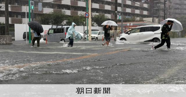
What made Typhoon 25 unusual was not its strength — though it was large and fierce, with maximum wind gusts of 55 meters per second and a central pressure of 960 hectopascals — but where it dumped rain. Kimitsu in Chiba recorded 377.5 millimeters in 24 hours, a new national observation record. Funabashi, Ichihara, and Miura all broke their own records. Oshima Town, a Tokyo outlying island, absorbed 583 millimeters over just three days. The ground there was already saturated before Typhoon 25 arrived.
And then it kept raining.
Who Lives Where Matters More Than the Weather
The evacuation orders issued across six prefectures — roughly 90,200 households, 190,900 people — are staggering in scale. But they also expose a structural vulnerability that Japanese authorities have known about for decades and done little to fix: suburban hillside communities.
Kanagawa and Chiba are among the fastest-growing suburbs in the Tokyo metropolitan area. Over the past forty years, developers carved housing into steep slopes around Yokosuka, Miura, Ichihara, and Kimitsu — often on land that was forest or farmland before permit restrictions tightened in the 1990s. Retaining walls were built, drainage was altered, and the hills became home. When storms intensify, these slopes fail.
The two deaths and four missing persons emerged from exactly this geography. A woman trapped in a first-floor apartment as mud poured in at Miura. A 70-year-old couple unreachable in a collapsed house in Yowa, Miura. A 51-year-old contractor swept into a river while clearing debris in Sodegaura. These are not abstract casualty numbers — they are residents of slope-adjacent neighborhoods where the mountain meets the mailbox.
The Warning System Is Working. The Ground Is Not.
Chiba Prefecture issued Level 5 emergency safety assurance orders in rapid succession throughout the afternoon and evening. Kimitsu at 4:30 p.m., citing flash flooding risks near the Koito River. Sodegaura and Ichihara followed, covering over 40,000 and over 50,000 residents respectively. Level 5 is the highest tier in Japan’s evacuation warning system, meaning immediate danger to life and evacuation is mandatory.
The Japan Meteorological Agency also issued a Level 5 special landslide warning for Oshima Town at 12:40 p.m., later downgrading it to Level 4 at 11 p.m. as the storm moved away. The system flagged the danger accurately and early. What the system cannot flag is which specific retaining wall will fail, which specific slope will slide, or which specific house will be buried.
That gap — between macro-level warning and micro-level exposure — is where Japan’s disaster preparedness falls shortest. The warnings are issued at the municipality level. Individual homes sit on terrain that no warning system can monitor in real time.
The Climate Signal Is Clear
The rainfall records written on September 21 are not anomalies. They are consistent with what climate scientists have projected for Japan’s typhoon season. Warmer atmospheric temperatures hold more moisture — roughly seven percent more per degree Celsius of warming — and Japan has warmed by about 1.3°C since the pre-industrial era. Typhoons that once moved quickly through the region are now stalling, dumping rain over the same area for longer periods. The 583 millimeters Oshima Town received in three days reflects exactly this pattern: a slow-moving, moisture-rich system.
Japan’s Meteorological Agency has noted an increase in extreme precipitation events associated with typhoons since the 1980s. The record rains in Kimitsu, Funabashi, and the other cities on September 21 are the latest data point in a long trend. The question is no longer whether storms like Typhoon 25 will become more common. It is whether the communities built on the slopes beneath them will survive the transition.
Who Wins, Who Loses
The winners in this scenario are predictable: insurance companies that priced the risk before the losses arrived, construction firms that build and rebuild retaining walls, and the Self-Defense Forces that deploy for disaster response — they are already mobilized in Miura and Sodegaura.
The losers are the residents of hillside suburbs who face repeated evacuations, rising insurance premiums, and the quiet erosion of property value in areas that climate models now classify as high-risk. Yokosuka, Miura, Ichihara, and Kimitsu are not coastal flood zones. They are slope zones — a category that receives far less public attention and far less federal investment in adaptation infrastructure.
Tokyo Electric Power Grid reported approximately 60,000 homes without power across the Kanto region by 10 p.m. On Oshima Town, the power and communication disruptions are likely worse. The economic costs are mounting: JR East suspended trains on the Sobo and Uchibo lines, airlines canceled dozens of flights, and the Tokyo Game Show was postponed. The human cost — two dead, four missing — is what makes this a disaster rather than an inconvenience.
What Happens Next
Typhoon 25 is expected to pass east of Japan by the morning of September 22. The Japan Meteorological Agency is warning of continued landslide risk across the Pacific side of eastern and northeastern Japan through that day. The search for the four missing persons — two in Kanagawa, one each in Chiba and likely another in the slope zones nearby — will continue through the weekend.
But the real story is what comes after the recovery phase. Japan faces a demographic reality that complicates every disaster policy discussion: the populations of hillside suburban municipalities are aging and shrinking. The 70-year-old couple unreachable in Miura, the 64-year-old woman in Yokosuka — these are not edge cases. They represent the demographic profile of the residents most exposed to slope failure.
Local governments have the legal authority to designate landslide disaster prevention areas and restrict new development. Few have used it aggressively. The evacuation orders for 190,900 people are a reminder that warning alone is not protection. The residents of Kanagawa and Chiba’s slope suburbs will need more than Level 5 alerts when the next typhoon arrives. They will need relocation plans, retrofitting programs, and a honest conversation about whether some hillsides should remain empty.
The rain records from September 21 will stand until Typhoon 26 — or whatever the next system is called — breaks them. The question is what Japan does in the time between.