Nepal's Debris Flow Exposes a Silent Mountain Emergency
A catastrophic debris flow in northern Nepal this August reveals how altitude-amplified warming is destabilizing Himalayan slopes at twice the global average rate — a threat that extends far downstream into India and Bangladesh.
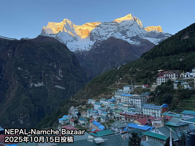
A Mountain Under Fire
On August 26, 2026, a massive debris flow tore through northern Nepal, leaving serious human and economic damage in its wake. The event should not be read as a one-off disaster. Weather News’ analysis of local climate data found that temperatures around the collapse zone were rising at roughly twice the global average — a pattern that points to a deeper, slower-moving crisis eating away at the Himalayas from the top down.
This is elevation-dependent warming, sometimes called EDW, and it is one of the most underreported mechanisms of climate change. The world averages a certain temperature rise each decade. Mountains, especially high-altitude zones, are warming faster. The result is not just warmer air — it is a fundamental reconfiguration of the terrain itself.
The immediate toll includes at least several dozen casualties, dozens more missing, and entire villages cut off from supply routes for weeks. But the death count tells only part of the story. Roads that serve as lifelines for remote districts are buried under tons of rock and soil. Livestock losses are wiping out the savings of families who had no other safety net. A bridge critical to agricultural transport collapsed, severing a corridor that connects subsistence farms to market towns. These are not abstract numbers — they are the quiet erosion of livelihoods that compound long after the dust settles.
The Feedback Loop That Melts Mountains
The physics are not complicated, but their consequences are brutal. Snow and ice reflect sunlight. When temperatures climb, ice melts. Exposed ground absorbs far more solar radiation than bright white snow ever could. That absorbed heat warms the surrounding area, which melts more ice, which exposes more ground. It is a self-reinforcing loop that accelerates on its own.
There is a second amplifier. Warmer air holds more water vapor. Water vapor is a greenhouse gas. It traps outgoing heat and makes nights harder to cool down. Together, these two processes — surface darkening and atmospheric thickening — make high elevations disproportionately vulnerable.
In the Nepalese collapse zone, that vulnerability has turned into catastrophe. Long-term temperature records show a warming rate approximately double the global mean. Through the summer of 2026, temperatures across Asia’s glacial regions remained well above normal. What was stable ground became unstable ground. And then it moved.
What makes this particularly insidious is the lag effect. Permafrost — frozen ground that has held mountain slopes together for millennia — does not surrender all at once. It thaws in stages, weakening the cement that binds rock and soil. The debris flow on August 26 was likely the culmination of months, possibly years, of gradual degradation. The slope was dying long before it announced its death. This means that warning signs are often invisible in real time. Communities sitting atop compromised ground may have no reason to suspect danger until the moment it arrives.
Who Is Downstream
Nepal is only the starting point of this story. The Himalayas feed some of the largest river systems on Earth — the Ganges, the Brahmaputra, the Indus. Hundreds of millions of people live in the plains downstream, in northern India, Bangladesh, and eastern Pakistan. When mountain slopes fail, the consequences do not stop at the valley floor.
Debris flows carry sediment, boulders, and uprooted trees into river channels. They can dam rivers temporarily, creating lakes that may later burst. They can clog water intakes, damage hydropower infrastructure, and render roads impassable for months. The economic cost is immediate; the humanitarian cost stretches across monsoon seasons and growing seasons.
The second-order effects are where the real scale of the crisis emerges. Sediment loading alters river chemistry and smothers fish spawning grounds, undermining fisheries that feed thousands. The temporary lakes created by debris dams pose their own ticking clocks — when they breach, the resulting floodwaters can devastate communities hundreds of kilometers downstream, even if the original slope failure caused little direct harm. Hydropower stations, already strained by erratic flow patterns, face new risks from sudden surges of debris and altered water volumes.
No one knows exactly how many more events like the August 2026 debris flow are coming. But the directional signal is clear: as high-altitude temperatures continue to rise, slopes that held for centuries are becoming less reliable. The timing of individual failures may be unpredictable, but the trajectory is not.
Japan’s Own Mountain Problem
The source reporting does not frame this as a distant problem. Japan retains patches of permafrost and small remnant glaciers in the Northern and Southern Alps, including the Tateyama range. These are not vast ice fields, but they are real, and they are shrinking. Warmer summers and intensifying heat waves accelerate melt and weaken mountain faces.
This matters beyond mountaineering. Slope instability threatens hiking trails, ski resorts, and remote villages. It alters habitats for alpine flora and fauna that cannot migrate fast enough. And it is a preview of what happens everywhere mountains meet rising temperatures.
Japan’s experience offers a sobering parallel. The Tateyama range has seen increasing rockfall activity in recent years, and local authorities have been forced to close sections of road and reroute trails without warning. These are not large-scale catastrophes like the Nepal event, but they represent the same underlying mechanism — permafrost degradation, ice loss, structural weakening — playing out on a smaller stage. If Japan can confront these risks despite its wealth and infrastructure, the challenge facing Nepal and its neighbors is all the more stark.
Why This Story Is Still Under the Radar
For decades, the high Himalayas were under-observed. There simply were not enough weather stations on the peaks and ridges to capture what was happening in real time. Scientists inferred trends from sparse data. Now, satellite monitoring and expanded ground networks are filling the gap — and the picture they reveal is more urgent than the extrapolations suggested.
Weather News notes that a follow-up report will examine the mechanics of the slope collapse itself, including the role of glacier dynamics. That detail will matter. But the broader takeaway should already be clear: elevation-dependent warming is not a slow background process. It is an active driver of geomorphic change, and it is accelerating.
The gap between what we know and what the public understands remains wide. Climate discourse still fixates on sea-level rise, extreme heat in populated valleys, and drought — all critical issues, but all focused on lowland experiences. The mountains are warming first, and they are changing the terms of the conversation from up high. Every major debris flow, every sudden glacier lake outburst, every section of road lost to rockfall is evidence of a landscape in transition. These events are not yet framed as climate signals in most news coverage, which treats them as weather stories or infrastructure failures rather than symptoms of a systemic shift.
What Changes Next
Downstream communities in India and Bangladesh need early warning systems that account for high-altitude triggers, not just rainfall thresholds. A slope can begin to fail days before any rain falls. Hydropower operators need risk assessments that incorporate warming-trend scenarios, not just historical patterns. Urban planners along the foothills need to understand that the geography beneath them is shifting.
For Nepal, the immediate task is disaster response and reconstruction. The longer-term task is to treat mountain warming as a structural risk, the way coastal nations treat sea-level rise. That means investment in monitoring, in land-use policy, and in cross-border data sharing — because the water that threads through these mountains does not respect national boundaries.
The debris flow in northern Nepal is a symptom. The disease is a mountain range that is heating up faster than anything lowland observers expected. We are entering an era where the highest places on Earth are changing the fastest, and the people who benefit most from those mountains — the billions who depend on the rivers they feed — are the ones least equipped to respond. The next slope to move may not give as much notice.