The worst El Niño in history is coming. Here's what stands between us and catastrophe
Sea surface temperatures in the central Pacific are running more than a degree warmer than the 1997 and 2015 super El Niños at the same stage. With a 90% chance this becomes the largest on record, the clock is ticking for drought-stricken southern Africa and fire-vulnerable Indonesia.
The numbers that should terrify everyone
Every morning, Zeke Hausfather pulls forecasts from 14 leading climate models into a real-time dashboard. For months now, the numbers have told a story that gets stranger with each passing week.
In early September, sea surface temperatures in the central tropical Pacific sat roughly 2.9°C above the current climate baseline — the 30-year average. That sounds precise. It should sound alarming. The key figure is the comparison to the two most powerful El Niño events in modern memory: 1997 and 2015. At the same stage of development, this year’s event was more than a full degree Celsius warmer than either of them. Hausfather, who works as a climate scientist at Berkeley Earth and leads climate research at Stripe, put it plainly: forecasts now indicate better than a 90% chance that this year’s El Niño will surpass every recorded event dating back to the 1870s.
The “super El Niño” label is not new. Scientists have used it for years to describe events that push past the threshold of typical strong episodes. What makes 2026 different is not the category. It is the margin.
Southern Africa has weeks, not months
The most predictable consequence of a strong El Niño is drought in southern Africa. During the four strongest events between 1980 and 2016, the region faced roughly an 80% chance of below-normal rainfall during the critical December-to-February wet season. The 2023–24 event, already considered moderate by many measures, triggered disaster declarations in Zimbabwe, Zambia, and Malawi. The Zambezi River dropped to its lowest recorded flow.
South Africa’s maize harvest fell by nearly half during the 2015–16 El Niño. Maize is not a luxury crop in this region — it is a staple. When it fails, food prices spike, households stretch thinner, and the risk of unrest rises.
The planting season begins in October. That is a matter of weeks. Agricultural ministries that have not already moved to distribute drought-tolerant and early-maturing crop varieties in high-risk areas are already behind. Ethiopia’s experience during the 2015–16 drought offers a template: expanded safety-net programmes that deliver support when harvests fail, rather than waiting for famine to announce itself. Southern African governments should adopt similar frameworks now.
The math is unkind. A weaker El Niño like 2023–24 produced widespread hardship. Something one degree warmer at the same stage will not produce proportionally worse outcomes — climate systems do not work linearly — but they will produce outcomes that some regions have no institutional memory of surviving.
Indonesia’s peatlands are a ticking source
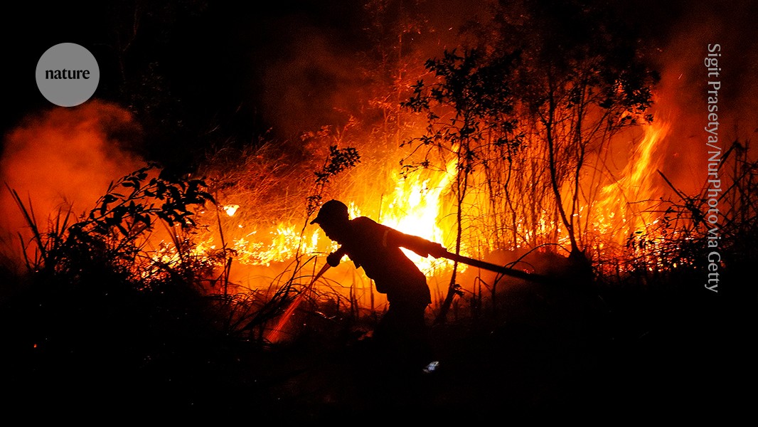
Rainfall is already declining across Indonesia, and the risk of peatland fires is climbing. Peatlands store carbon in waterlogged soil. When they dry out and burn, that carbon escapes as CO₂ at rates that dwarf most national emissions.
The 1997 El Niño drove Indonesian fires that released an estimated 3 to 9 gigatonnes of CO₂ — equivalent to roughly 13% to 40% of global fossil-fuel emissions that year. The 2015 event produced fires and haze linked to approximately 100,000 excess deaths across Indonesia, Malaysia, and Singapore. The Indonesian government responded by establishing a peatland restoration agency and restricting the clearing of primary forests and peatlands. Those measures mattered. They did not eliminate the danger.
A super El Niño arriving on top of a warming baseline means drier peatlands, longer dry seasons, and a higher probability that any ignition — whether from agricultural burning or lightning — becomes uncontrollable. Early prevention is far cheaper than early response. Burn detection, rapid firefighting deployment, and peatland rewetting should be funded and operational now, not after the first major fire season bites.
The Amazon, the oceans, and the blind spots
Hausfather does not mention the Amazon in this particular piece, but it is impossible to read the data without thinking about it. A super El Niño can transform the rainforest’s moisture cycle, pushing parts of the basin toward savannization — a regime shift from forest to grassland that would release vast stores of carbon and collapse biodiversity. The science is not settled on the threshold, but the direction of travel is clear.
Coral bleaching is already underway in multiple ocean basins. Warmer seas stress the symbiotic algae that corals depend on. Mass bleaching events tied to El Niño have become more frequent with each decade. This year’s event risks the most severe global bleaching pulse since 2016, which killed an estimated 29% of shallow-water corals on the Great Barrier Reef.
Perhaps the most underappreciated blind spot is the interaction between El Niño and already-stressed food systems. Heatwaves exposed weak links in global supply chains in recent years. A super El Niño叠加 on top of existing vulnerabilities — climate-driven yield volatility, geopolitical disruption to grain exports, rising input costs — could push multiple regions toward simultaneous shortfalls. The 2022 World Food Programme reports already warned about compounding shocks. This year’s forecast changes the calculation from “if” to “when.”
What governments should do, starting this week
The World Health Organization, national agriculture ministries, and disaster-management agencies have been issuing warnings for months. Warnings are not preparation. Preparation requires funding, logistics, and political will.
Three priorities stand out:
First, southern African governments must activate drought-response frameworks before the rains fail. That means seed distributions, irrigation support, and social-protection triggers that activate automatically when rainfall deficits reach certain thresholds. Ethiopia’s model proves this is possible.
Second, Indonesia and other Southeast Asian nations must invest in peatland hydrology. Rewetting drained peatlands prevents fires more effectively than fighting them. The technology exists. The financing does not come naturally from domestic budgets alone — international climate finance should prioritise this category.
Third, every government with coastal population centres needs to treat coral-reef fisheries as critical infrastructure. When reefs bleach, fish stocks collapse. Fishers lose livelihoods. Protein sources vanish for communities that have no alternative. Early warning systems for marine heatwaves should feed directly into fisheries management plans.
The uncomfortable truth
The super El Niño is not the same as climate change. It is a natural climate oscillation, one that has occurred for millennia. But it is arriving on a planet that is already warmer, already drier in vulnerable regions, and already strained by decades of underinvestment in public resilience.
The 2.9°C anomaly above baseline is striking. But the deeper story is that the world’s capacity to absorb shock has not kept pace with the scale of the shock arriving. That gap is what turns a severe weather event into a catastrophe.
Closing that gap is expensive. Leaving it open is far more expensive. The window for action in southern Africa is measured in weeks. For Indonesia, it is measured in months. For the rest of the world, it is measured in whatever time remains before the next model run updates the forecast — and the numbers get worse.